Fig. 01 — Conceptual massing study, four stories. Not a permitted set; intended to convey the corner’s development character.
§ 01 · The Premise
Four contiguous parcels at a working corner in Bayside —
two houses, a duplex, and a vacant lot —
held in single ownership and offered as one assemblage.
The properties carry themselves on rents today.
The land underneath them is what the buyer will pay for.
For the buyer with a vision
A walkable corner two minutes from Munjoy Hill, three from Back Cove,
and one block from Portland Housing Authority’s 173-unit COMB Block
approval. The neighborhood’s next chapter is being written in
building permits.
For the developer
A consolidated 11,417-square-foot site in RN-4,
eligible — subject to verification — for ReCode’s Inclusionary
Zoning bonus and Maine LD2003’s 2.5× density multiplier.
A pre-application meeting with Portland Planning is the next step.
For the developer’s agent
Income in place to underwrite carrying costs through entitlements.
Single-owner LLC simplifies title. Survey on file.
Seller will entertain offers contingent on a feasibility period —
and is open to joint-venture or
seller financing with the right partner.
OFFERED AT
$3,000,000
4 parcels · 0.262 acres · 11,417 sq ft$263 / sf of land3 buildings · 14 bedrooms in-place
Terms
Open to joint venture and seller financing.
The seller will entertain a structured deal with the right partner.
§ 02
The Site
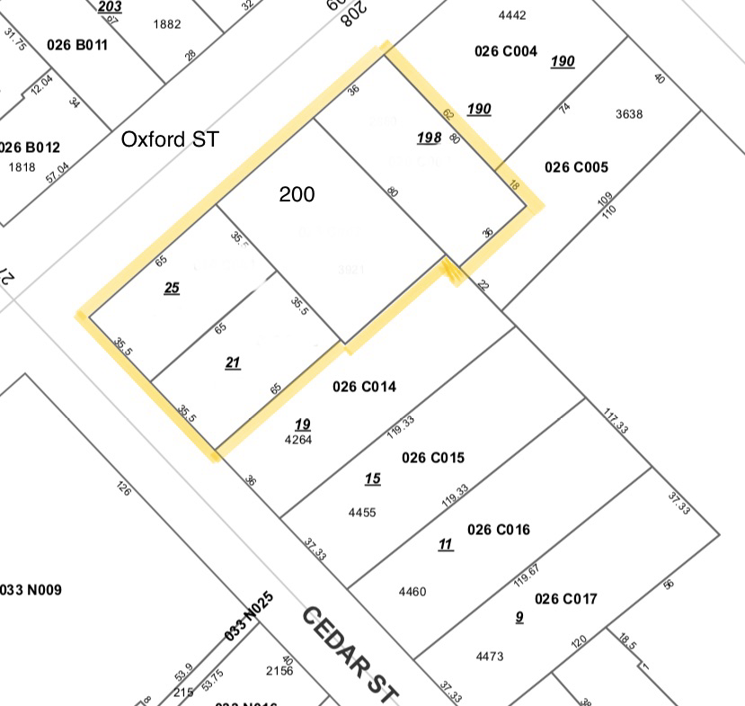
The four parcels form an L around the southwest corner of Oxford and Cedar.
Two front Oxford Street — 198 (two-unit) and the vacant 200,
which retains two concrete slabs (11′×40′ and 11′×36′).
Two front Cedar Street — 25 (two-unit) and 21 (single-family).
Fig. 02 — City of Portland tax map. Subject parcels outlined in yellow.
Hover either the map or the table to highlight a parcel.
Parcel
Use
Lot
Bed/Bath
2026 Rent /mo
198 Oxford St
Two-unit · gas heat / Rinnai
0.066 ac · 2,879 sf
4 / 2
$5,300
200 Oxford St
Vacant land · two concrete slabs
0.090 ac · 3,920 sf
—
—
25 Cedar St
Two-unit · steam radiators · gas furnace
0.053 ac · 2,309 sf
5 / 2
$4,843
21 Cedar St
Single-family · gas heat
0.053 ac · 2,309 sf
5 / 2
$4,732
TOTAL
3 buildings + dev. parcel
0.262 ac · 11,417 sf
14 / 6
$14,875
§ 03
Income, Today
The package is fully tenanted (excepting the development parcel).
The seller has provided a 2025 actual and a 2026 projection,
reflecting Portland’s 2.2% CPI rent allowance and a vacancy turn at 21 Cedar.
2026 GROSS RENT (PROJ.)
$178,500/yr
$14,875 monthly across 3 buildings
2025 ACTUAL GROSS
$171,948/yr
$14,329 monthly
TAXES (OCT’25 / MAR’26)
$20,263/yr
All four parcels combined
INSURANCE
$8,200/yr
200 Oxford fenced & uninsured
UTILITIES (LANDLORD-PAID)
$29,282/yr
Unitil · CMP · PWD; tenants pay 25 Cedar CMP
2026 NET OPERATING INCOME (EST.)
≈ $118,635/yr
After taxes, insurance, utilities, services & licenses · ≈ 3.7% cap at ask
The yield is not the story. The story is what the dirt is worth
once it is no longer pinned beneath three small buildings.
Income covers carry while that conversation is had with the City.
§ 04
The Vision
The seller’s working concept: a four-story corner building of brick
and dark cladding, ground-floor commercial activating Oxford,
a residential lobby on Cedar, balconies turning the corner.
Up to 40 dwelling units with the affordability
component required by Maine LD2003 — per the bonus math in
§ 05.
Renderings are conceptual. No application has been submitted.
Final program subject to City of Portland review.
§ 05
What the Code Allows
Three layers stack: Portland’s base zoning under ReCode, the
Inclusionary Zoning ordinance, and Maine LD2003’s state-mandated
density multiplier. Each is sourced; the math is shown.
01
Base Zoning · RN-4
The four parcels sit within Portland’s RN-4
Residential Neighborhood district under ReCode
Phase 2 (adopted 4 November 2024). RN-4 sets a
minimum lot area of 725 sq ft per dwelling unit
for multi-family, a 45-foot height limit for
buildings of three or more units, and 60% maximum lot coverage.
Off-street parking minimums for residential use have been
eliminated citywide.
Any project of 10 or more units triggers
Portland’s IZ ordinance: 25% of units affordable at ≤ 80%
AMI, or fee-in-lieu (≈ $182,830 / unit, current 2026 figure).
Compliance unlocks a +25% density bonus.
218 Washington Avenue used the IZ framework to deliver 45
condominiums (built under the prior ordinance).
For projects in which 51% or more of units are affordable
(≤80% AMI rental, ≤120% AMI for-sale), Maine’s
30-A M.R.S.A. § 4364 requires municipalities in designated
growth areas to allow a 2.5× density multiplier.
Portland has designated the entire mainland a growth area.
First large-scale project approved under the new rules:
Stroudwater Commons — 130 condominiums
(78 income-restricted + 52 market-rate) plus 26 ADUs on 4 acres,
vs. ≈ 8 units pre-ReCode.
Forty units is achievable on the Path B math, not a city
determination. Recently approved nearby projects (COMB
Block, Stroudwater Commons) demonstrate the city’s appetite
for density when paired with workforce housing. A pre-application
meeting with Portland Planning & Urban Development
(207-874-8721) is the recommended next step before underwriting a
unit count.
§ 06
In Context
Recent approvals and closings within a five-minute walk of the corner.
Comparable sales drawn from MLS sources.
APPROVED · ≈ 1 BLOCK
The COMB Block
Cumberland · Oxford · Mayo · Boyd · 1.53 ac
173 affordable units across three phases.
Demolition began in early 2026; completion targeted 2028–2029.
Owned by the Portland Housing Authority.
Built under Portland’s prior Inclusionary Zoning ordinance.
Forty-five units (21 one-bedrooms + 24 two-bedrooms) clearing
$700–$830 / sf in 2025–2026 sales.
APPROVED · 0.4 MI
Former Oxford Street Shelter Site
Avesta + Reveler Development · approved Jan 2025
Ninety-six mixed-income units — 28 Housing First, 20
income-restricted, 48 market-rate. A rebuilding of the same Oxford
Street corridor.
APPROVED · 0.5 MI
Solterra · 58 Boyd Street
PHA + Avesta + Evernorth · completed 2020
Fifty-five mixed-income units in a six-story building (23
efficiency, 10 one-bed, 13 two-bed, 9 three-bed); 80% at ≤60% AMI;
28 units with project-based vouchers.
FIRST UNDER LD2003
Stroudwater Commons
RN-1 · 4 ac · 130 condos + 26 ADUs
The first large-scale project approved under Portland’s
post-ReCode rules using the LD2003 density multiplier — 78
income-restricted + 52 market-rate condominiums plus 26 ADUs,
vs. roughly 8 units permissible pre-rewrite.
Sold Comparables — Maine MLS · Pulled 17 April 2026
Pulled from MLS sources covering every Portland multi-family
closing since January 2024 (n = 221) and every small-lot
infill land closing (n = 24). The most relevant trades
to Oxford & Cedar are below.
PORTLAND MF · MEDIAN $/UNIT
$315,000
Subject at ask = $291K/unit on 11 in-place units
PORTLAND MF · MEDIAN $/SF BLDG
$289
218 Washington Ave clearing $700–$830/sf new-build
PENINSULA LAND · TOP COMP
$138.70/sf
30-32 Atlantic St · April 2025 · 5,227 sf · R-6
Address
Date
Price
Units
Lot
Why it matters
★156 Oxford St
10 Oct 2025
$1,010,000
2
1,742 sf
New-build (2020) two-unit on the same street. $385/sf bldg, $580/sf land.
★55-57-59 St Lawrence
27 Feb 2026
$2,200,000
7
11,326 sf
Almost identical lot size. $314K/unit. Existing-building basis — no entitlement upside priced in.
★106 & 108 Cumberland
27 Dec 2024
$2,150,000
4
2,613 sf
Peninsula assemblage. $537K/unit, $355/sf bldg — sets upper end of in-place pricing.
★30-32 Atlantic St
8 Apr 2025
$725,000
land
5,227 sf
The cleanest raw-land comp in Bayside. R-6 zoning. $138.70/sf land.
★237-241 High St
12 Jan 2024
$2,200,000
19
9,148 sf
Closest scale-comp by units. $116K/unit, $162/sf bldg — institutional pricing for value-add.
↺25 Cedar St (subject)
23 Mar 2023
$550,000
2
2,178 sf
Last arms-length trade of one subject parcel. Up 2.6× from 2015 ($210,499).
The framing. The rent roll prices in line with
Portland’s multifamily median. The land alone, even at
peninsula-premium rates, prices below the asking. The premium is
the entitlement — the right to build into the bonus stack
described in § 05. No Portland multifamily asset has
closed above $3M in 2024-2026; the next comparable trade
will be the one that clears it. The seller is willing to be a
partner on that crossing — through a JV stake or by holding
paper — if the structure fits the project.
Bayside carries a general reputation for low ground — deserved for the
Marginal Way corridor, not for this corner. The property sits on the slope
that climbs from the former tidal flats up to Munjoy Hill. The authoritative
public data, read against the parcel, says so plainly.
FEMA FLOOD ZONE
Zone X
Area of Minimal Flood Hazard — outside the Special Flood Hazard Area. No NFIP coverage required. FIRM panel 23005C.
PARCEL ELEVATION
41–45 ft
USGS 3DEP LiDAR, NAVD88. Verified at each of the four parcel centroids.
MAINE HURRICANE EVAC ZONE
None
State of Maine “Know Your Zone” layer returns no evacuation zone for the parcel.
SLR + SURGE CLEARED THROUGH
+10.9 ft
The most extreme Maine MGS scenario — Highest Astronomical Tide plus combined SLR + storm surge. Parcels remain above water at every published step.
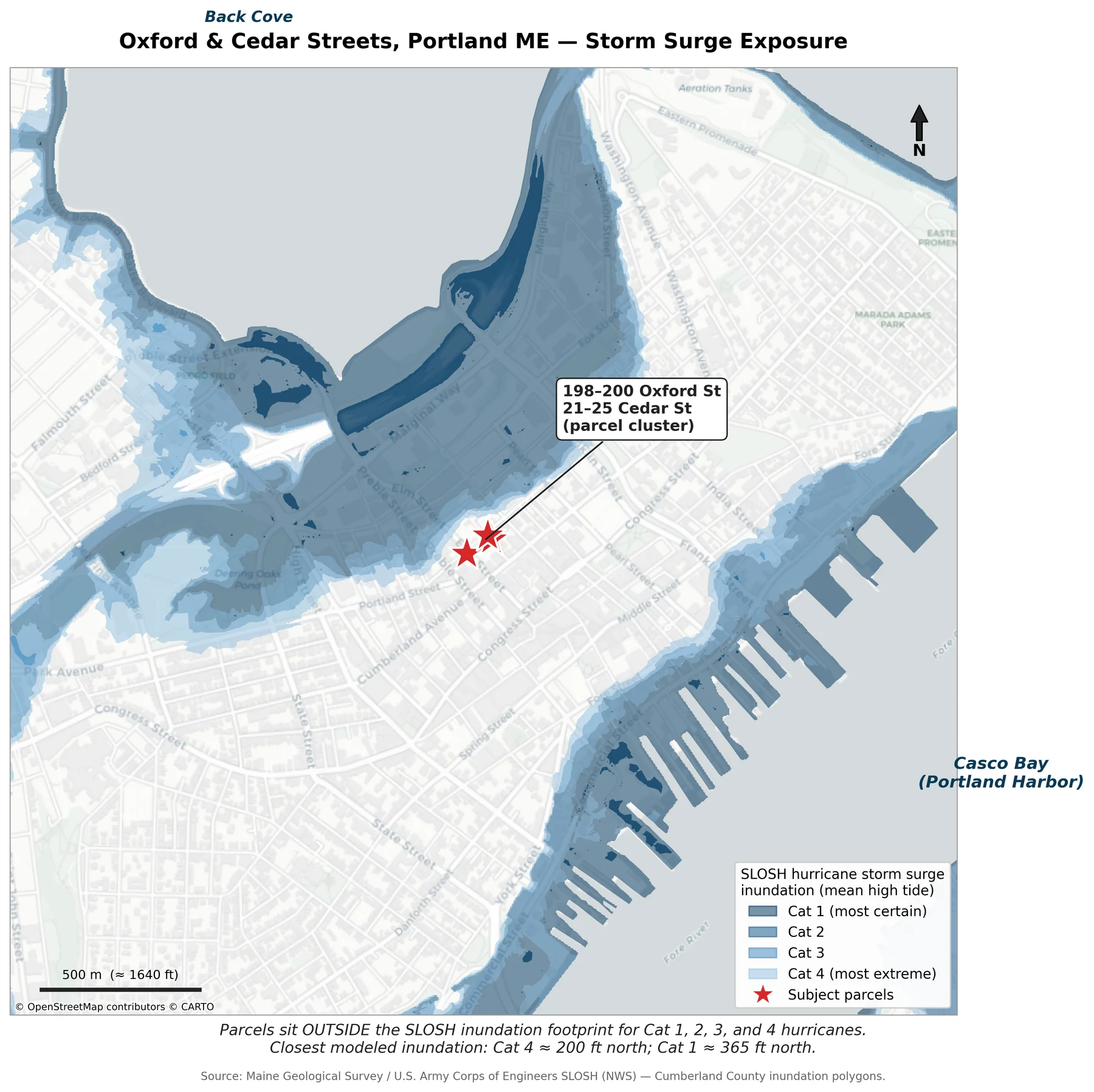
Fig. 07a —
SLOSH hurricane storm-surge inundation, Categories 1–4 at mean high tide.
The nearest modeled Cat 4 surge water reaches roughly
200 ft north of the corner; Cat 1 stays
365 ft away.
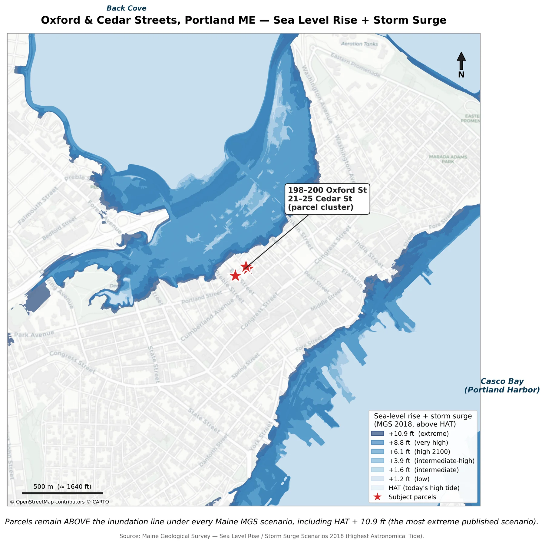
Fig. 07b —
Sea-level rise + storm surge scenarios, stacked above Highest Astronomical Tide.
The parcels remain on dry ground under every scenario Maine publishes,
including the HAT + 10.9 ft extreme.
The framing. Two minutes from Munjoy Hill, three from Back Cove,
one block from the COMB Block — and outside every storm surge footprint
the State of Maine and U.S. Army Corps of Engineers model. A buyer underwriting
a forty-year hold does not have to price climate risk the way a
waterfront peer does.
Sources: U.S. Army Corps of Engineers SLOSH model (NWS); Maine Geological Survey
— SLOSH Hurricane Inundation & SLR + Storm Surge Scenarios 2018;
FEMA NFHL FIRM 23005C (Cumberland County); USGS 3DEP LiDAR elevation;
Maine “Know Your Zone” evacuation layer. SLOSH accuracy is
±20%; modeled footprints exclude wave run-up, rainfall, and
freshwater flow. Analysis dated .
§ 08
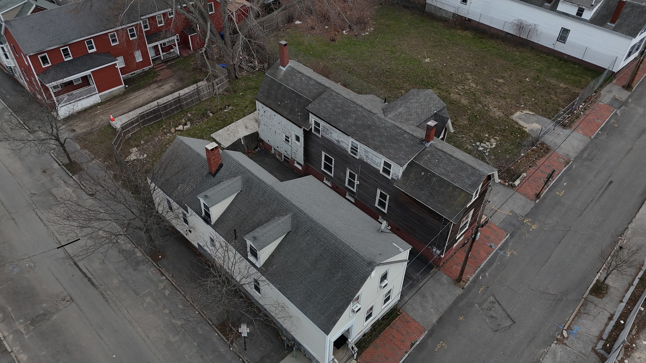
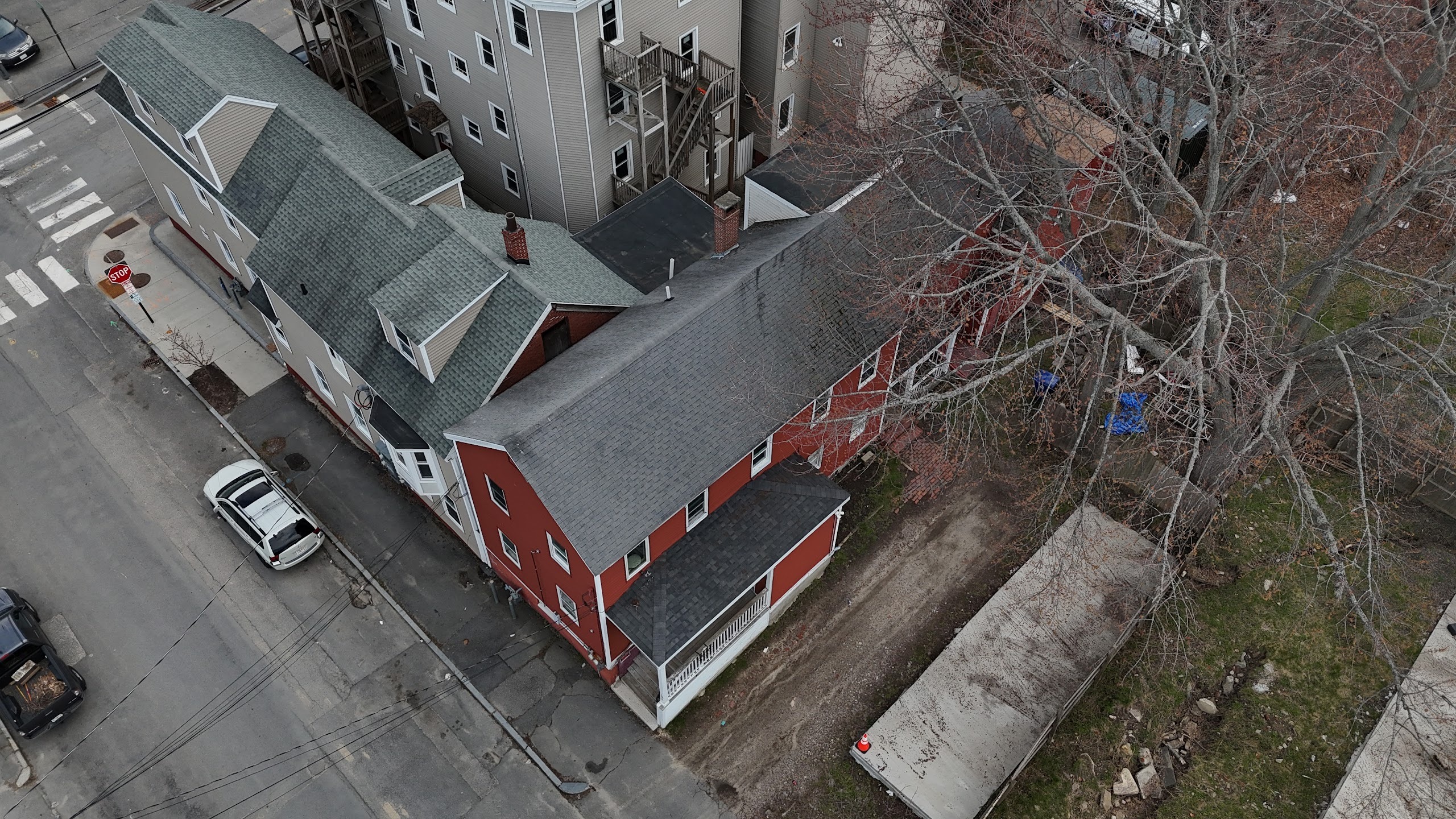
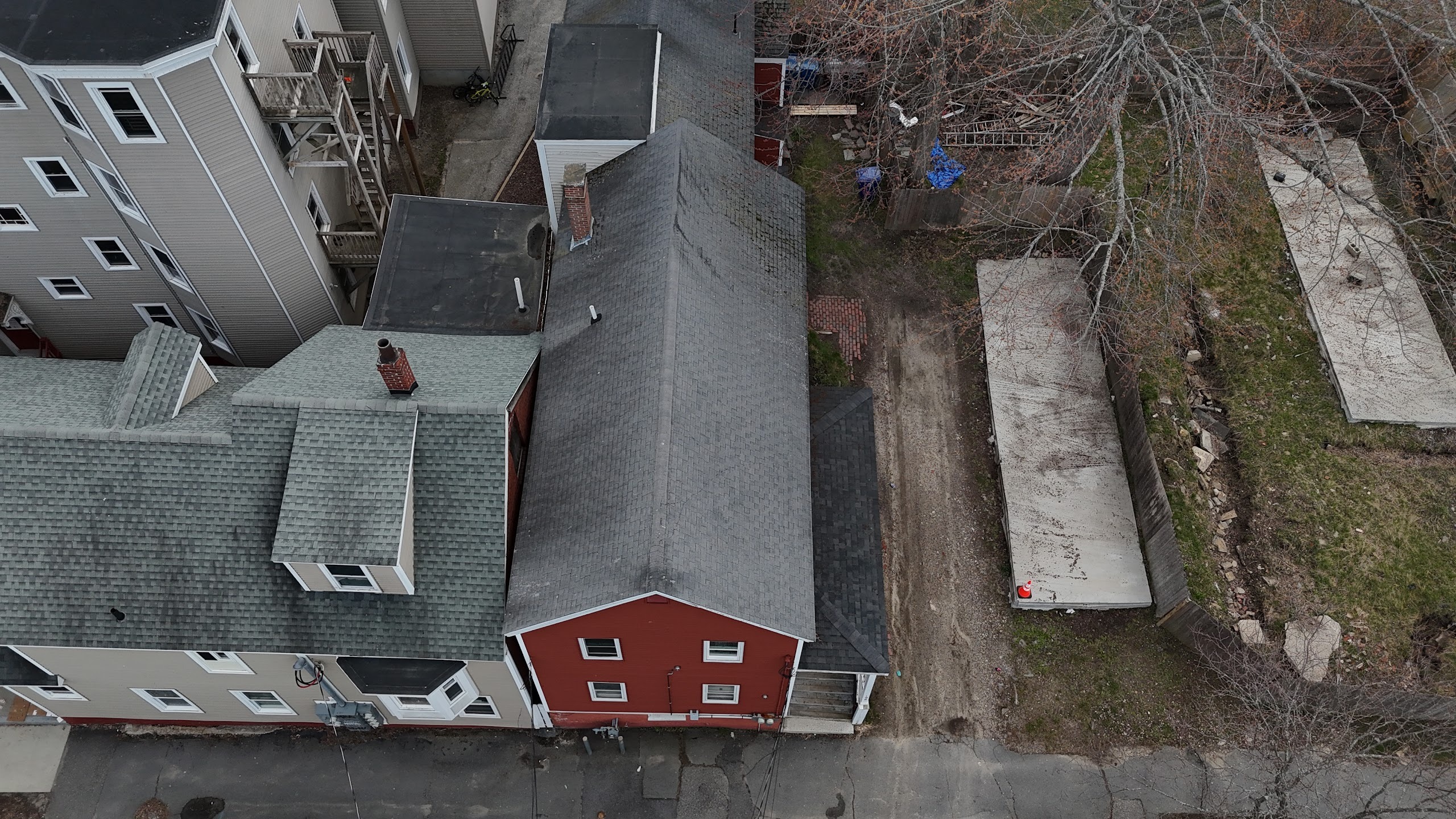
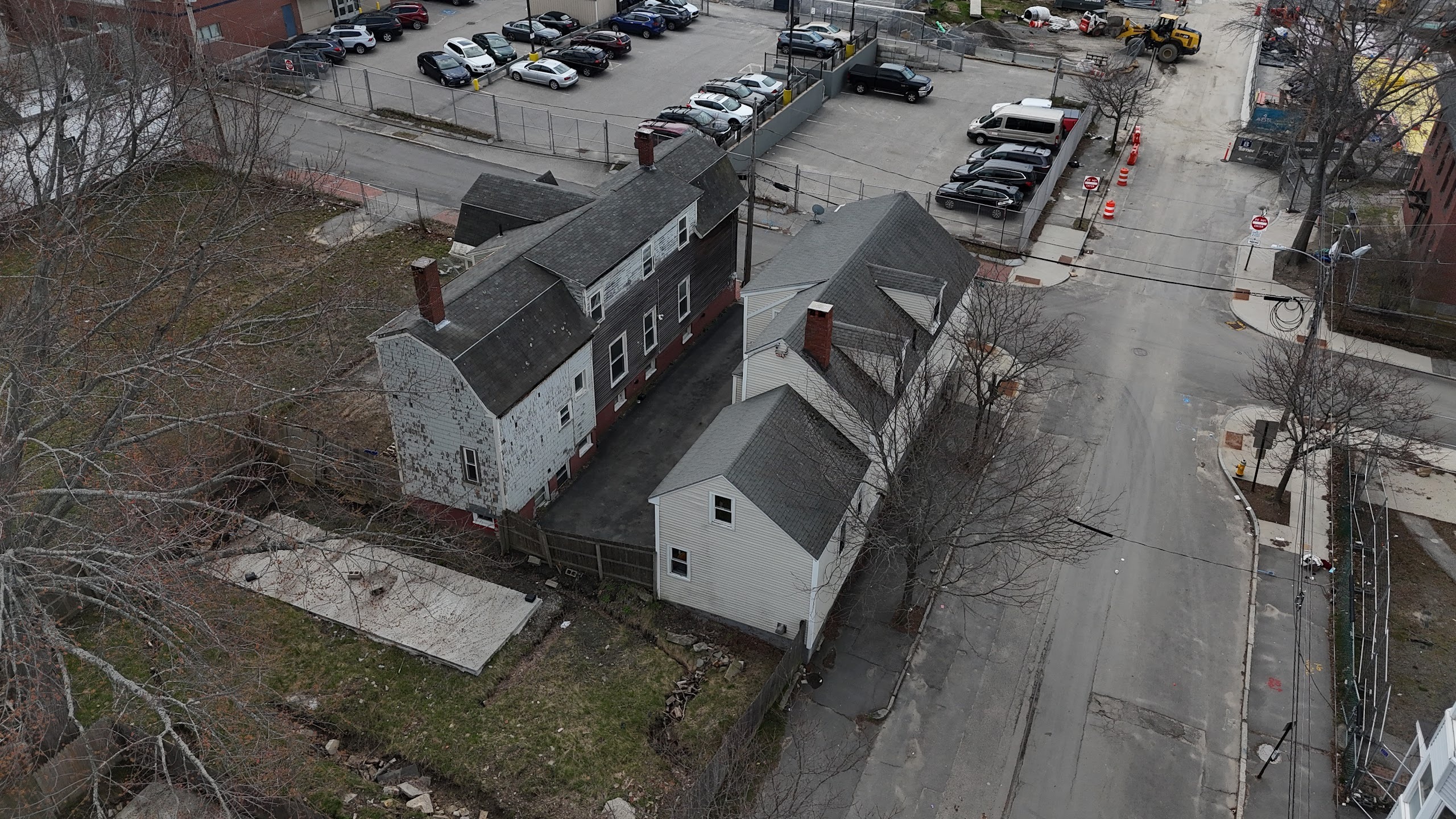
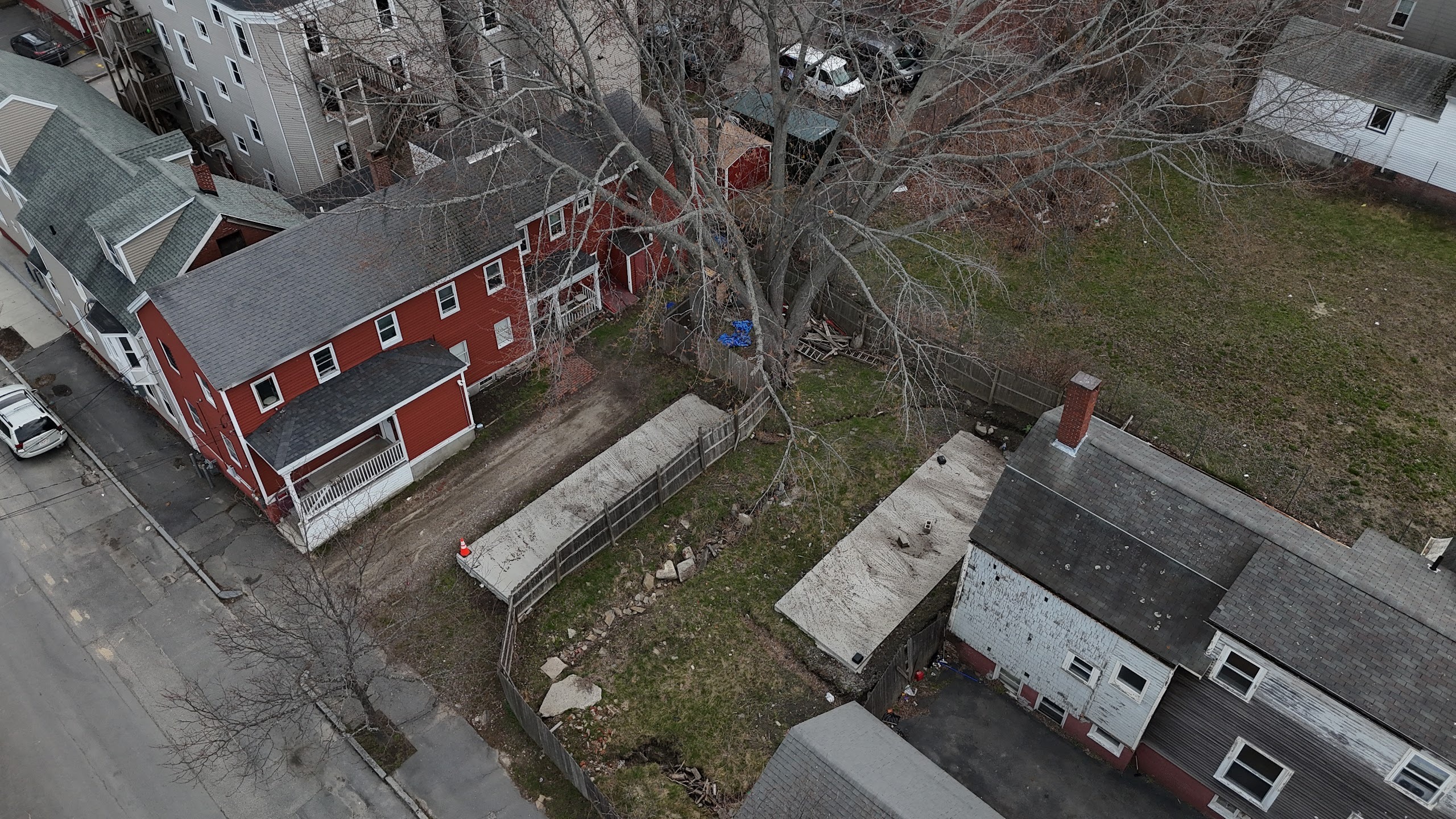
The Corner, Photographed
Drone aerials and street-level portraits, April 2026. The four
parcels form an L around the southwest corner of Oxford and Cedar.
Click any image to open at full resolution.
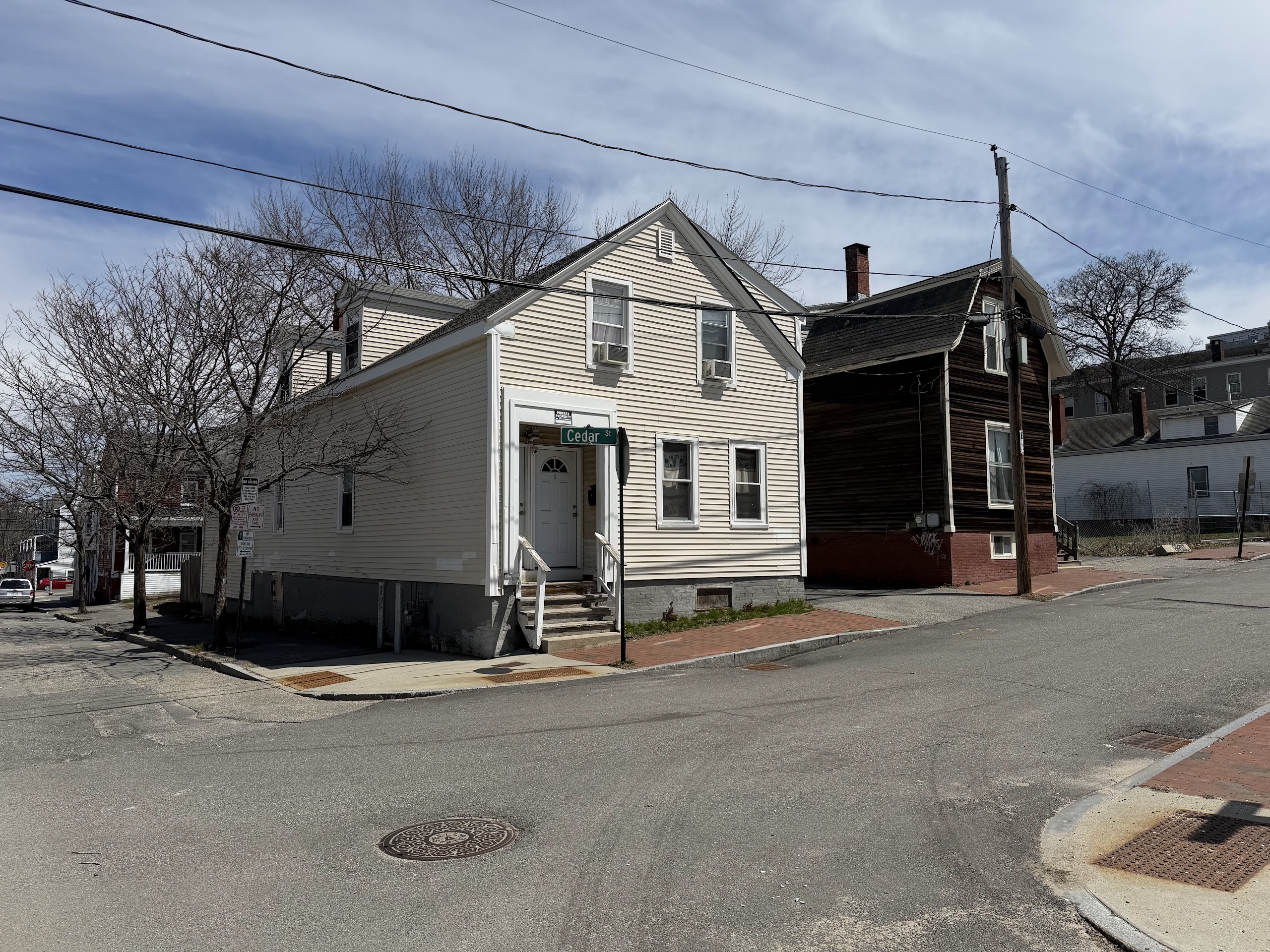
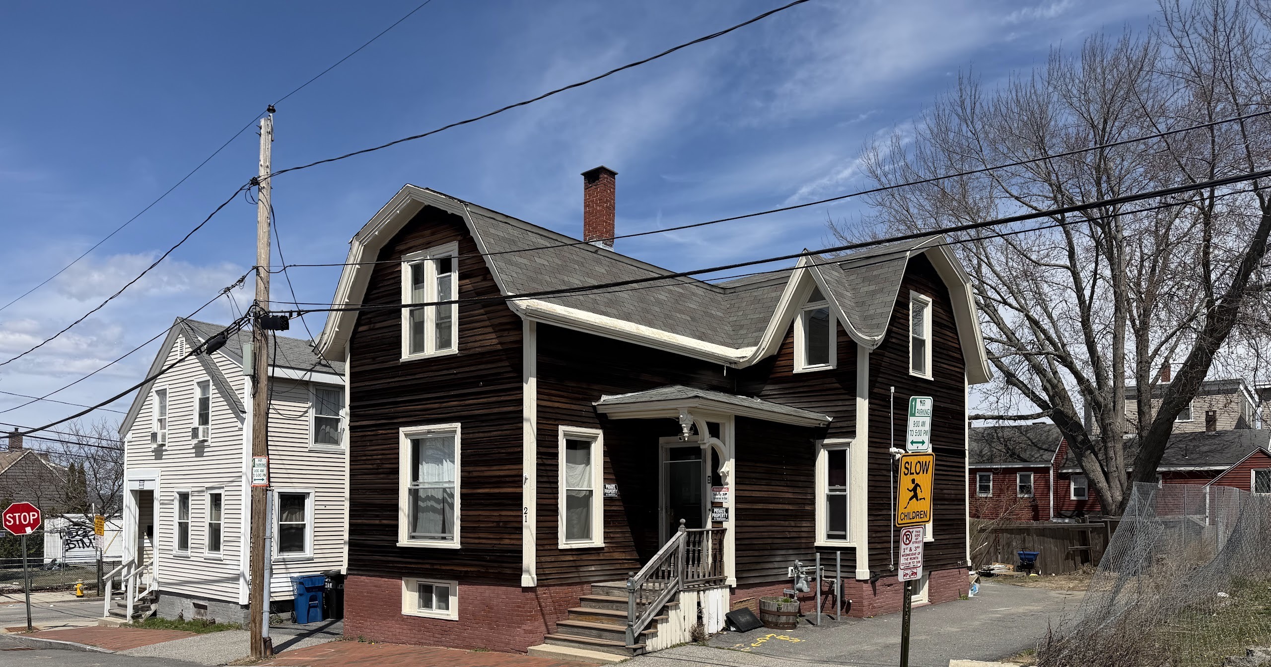
Plate 01 — 25 Cedar centered, 21 Cedar above it;
200 Oxford (the vacant parcel) and 198 Oxford visible behind.
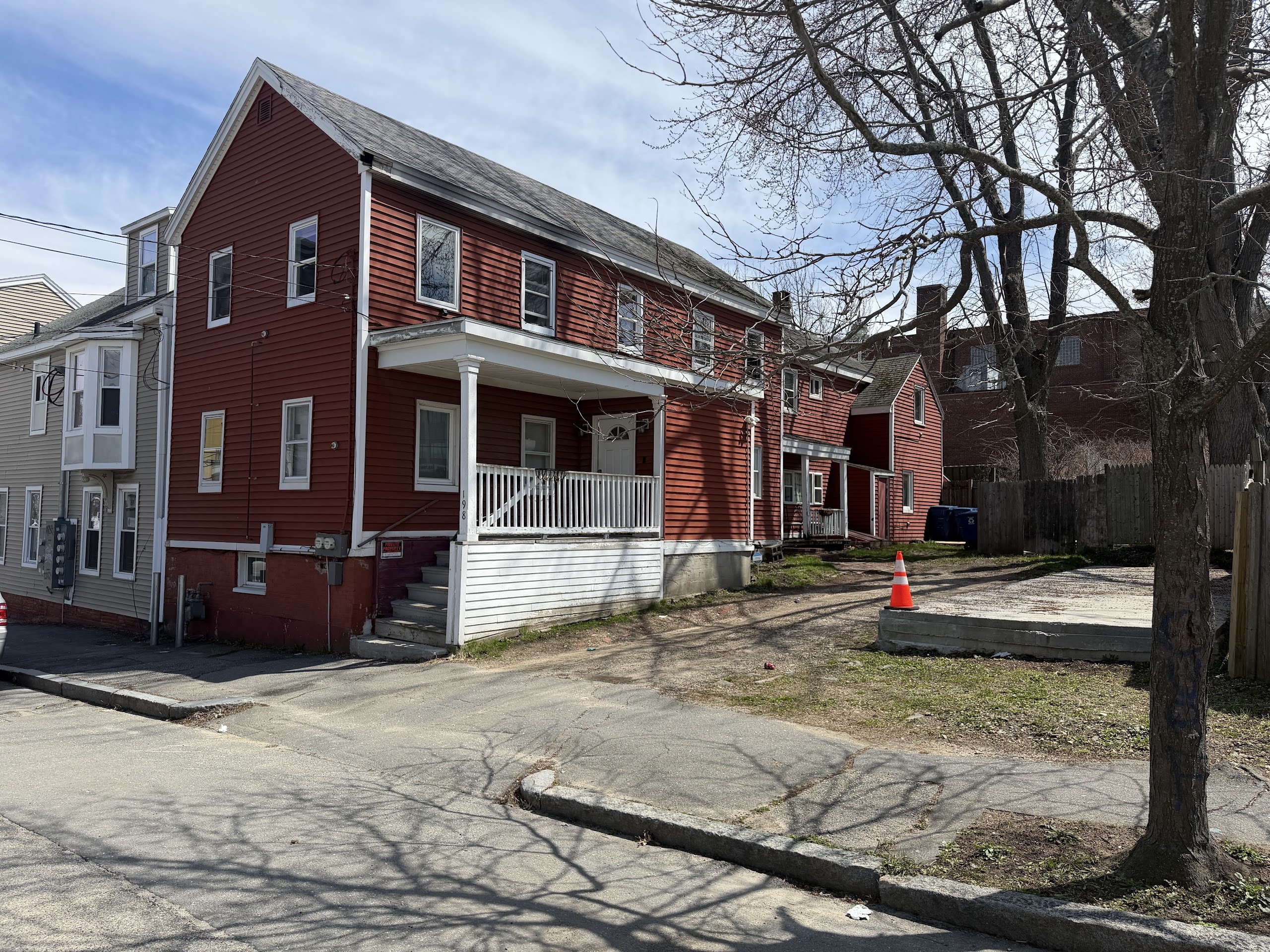
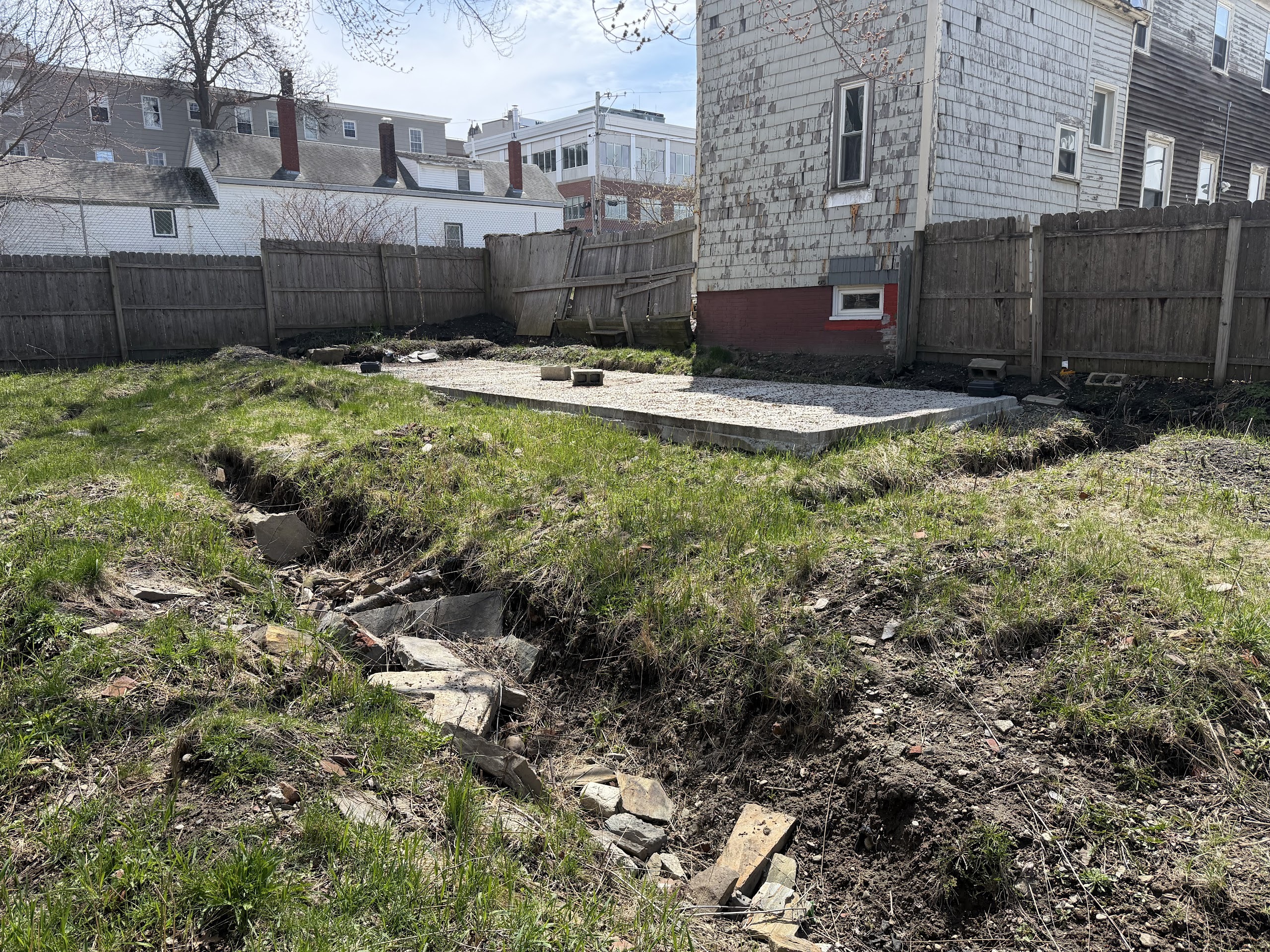
Plate 02 — 198 Oxford with one of the two concrete slabs at 200 Oxford visible in frame.Plate 03 — Roof of 198 Oxford and the two concrete slabs at 200 Oxford.Plate 04 — One of the 200 Oxford slabs with the rear of 25 & 21 Cedar.Plate 05 — The 200 Oxford slabs, 198 Oxford, and the rear of 21 Cedar.Plate 06 — 25 Cedar Street · two-unit · 5 BR · 2 BA.Plate 07 — 21 Cedar Street · single-family · 5 BR · 2 BA.Plate 08 — 198 Oxford Street · two-unit · 4 BR · 2 BA.Plate 09 — 200 Oxford Street · vacant development parcel · two concrete slabs (11′×40′ and 11′×36′).